

most recent update of this page
25 February 2023
































Ruta las Lagunas de Rabasa
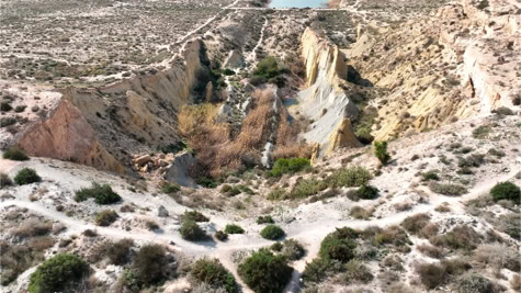
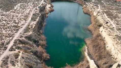
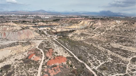
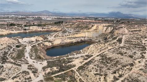
The lagunas or lakes of Rabasa are located in Alicante between the district of Rabasa and the A-70 highway. It is a piece of no man's land with a total area of 4,200,000 m² filled with desert landscape, sinkholes and clay hills. Little information can be found about the origin of these lagunas. If we follow the most logical and scientific theory, they would be the result of the mining activities in this area. In search of clay, the mines were excavated 15 to 20 meters deep. This activity pierced underground watercourses creating springs. In 1982, twelve years after the cessation of mining activity, nature took matters into its own hands and the resources began to replenish themselves. The water level rose to 65 and 70 meters above sea level. Three beautiful lakes were created. The Lago de Andara, the largest lake, the northernmost, is 350 meters long, has an area of 30,000 m² and is more than 20 meters deep. The southernmost lagoon, the lago el Senyoret, is 20,000 m² in size. In between is the smallest laguna with an area of 8,000 m². Two Civil War bunkers are located near the lagoons. These anti-aircraft batteries served to protect the airport of Rabasa.
At first glance, this place looks a bit deplorable and neglected. Here and there we find construction and household waste and even dumped vehicles. The combination of the greenish water, the blue sky and the ocher of the reeds attracts more and more locals and tourists. The hiking trails are not marked. You may be lost for a while, but you don't really get lost. There is more than enough parking space on the sand car park along Avinguda Jaume I. At the end of the car park (you leave the roundabout behind you), you have Calle Pilar de la Horadada on your right. At this point a trail begins straight through the first desert landscape. You will end up on a wider path (Camino Fondó Piqueres) where you turn left. Not much further you will see a fence on your right. Just after the fence you can choose from different paths. Follow the path uphill to the first bunker of Rabasa. Before you reach the bunker you have a beautiful view over the Lago el Senyoret. Once you arrive at the bunker, take the path downhill. Below is the mountain bike park. To the right, more to the north are the lago de Andara and the smallest lake. The path to the south takes you past the lago el Senyoret. Keep following this path and you will return to the wider path, the Camino Fondó Piqueres. Go to the left and a little further you cross the first desert landscape again on the right and you reach the parking lot again.
entrance fee
* free
opening hours
* always open
address
* parking at Avinguda Jaume I, Alicante
* GPS : 38°22'05.2"N 0°31'25.5"W - 38.368106, -0.523736
distance
* Torrevieja : 61 km, 56 minutes
* Guardamar : 41 km, 46 minutes
* La Marina : 39 km, 39 minutes